 Biner
BinerGoogle Earth to SketchUp: import a satellite image at real scale
A site model in SketchUp usually starts with an aerial image on the ground. Doing that by hand means taking screenshots, joining them, importing the picture and then scaling it against a known distance. EarthDL does these steps for you: it downloads the Google Earth imagery of your area and writes a SketchUp file where the image already lies flat on the ground, in real meters, facing north.
What you get in SketchUp
- One group with a textured face. 1 meter on the ground is 1 meter in the model, so you can measure and draw on it right away.
- The origin is at the center of the image and the green axis points north.
- The geo-location of the model is set (see File > Geo-location), so shadows follow the real sun position of the place.
- Big images are cut into texture pieces of at most 2048 px, because SketchUp shrinks larger textures and they turn blurry. The pieces overlap by a few pixels so no thin lines show at the joins.
- If you drew a polygon, the face has the shape of that polygon.
Steps
- Start EarthDL and choose the source Google Earth at the top.
- Type the place name or
lat, lonin the search box. - Drag a box around your site, or draw a polygon point by point.
- Choose the zoom. For a building plot zoom 19 or 20 is a good start, for a neighbourhood zoom 17 or 18. The estimate next to the selector shows the pixel size and the ground size in meters before anything is downloaded.
- Tick SketchUp, type a name and click Download.
- When the job is finished click Open in SketchUp, or open
sketchup\name.skpfrom the output folder.
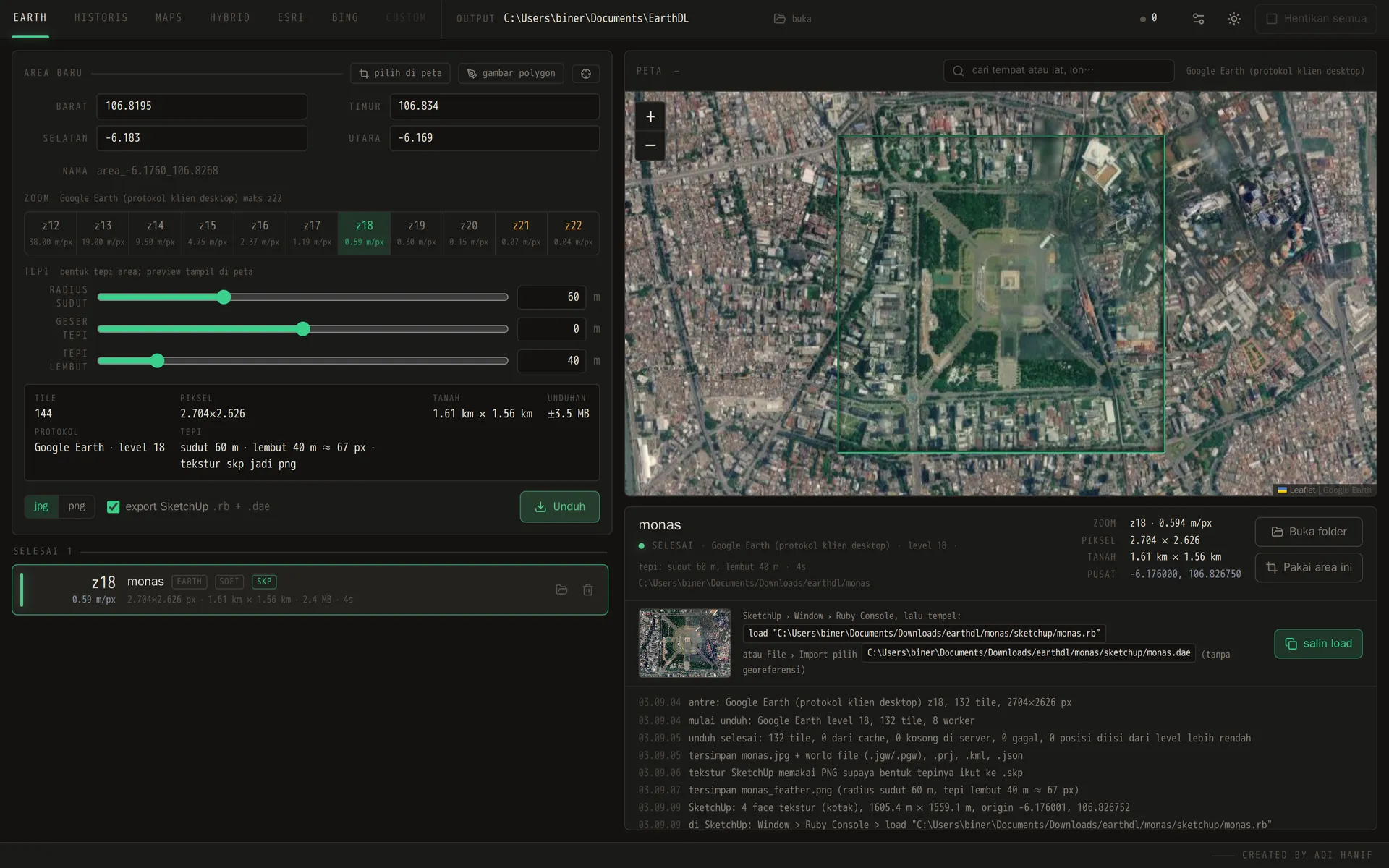
Finished job: the .skp file is written next to the image
If SketchUp is not on the same computer
The .skp file is written with the SketchUp library that comes with a SketchUp installation. On a computer without SketchUp, EarthDL still writes two other files that give the same model:
sketchup\name.rb: open the Ruby Console in SketchUp and runload "C:/path/to/name.rb". It builds the same textured face and sets the geo-location in the model that is open.sketchup\name.dae: use File > Import and choose the Collada file, with meters as the unit. This way does not set the geo-location.
Make the image blend into the model
A square photo on the ground ends with a hard cut. Set soft edge (feather) to some meters and the image fades to transparent at the border, so it blends into the ground color of your model. Corner radius rounds the corners. The examples on the EarthDL page show the same area with a hard edge, a soft edge and a rounded polygon.
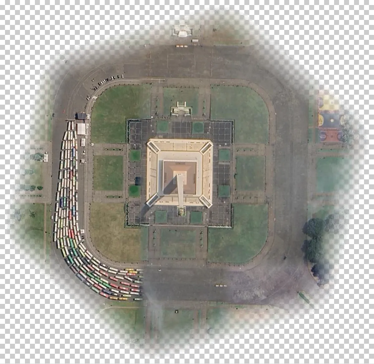
Polygon area, corner radius 60 m and soft edge 40 m
Older imagery
For a site that has changed, pick the source Google Earth historical and choose a date. See how to download historical Google Earth imagery.
Note: The downloaded offline images are only for your personal purpose, non-commercial use.
EarthDL costs $55, paid once. Buy | How to use | FAQ
More guides
- Satellite image in Blender at real scale (from Google Earth)
- How to download historical Google Earth imagery by date
- Georeferenced Google Earth image for QGIS, ArcGIS and Global Mapper
- EarthDL vs Google Earth Images Downloader (allmapsoft)
Last updated: Oct 3, 2026